From Durham/Cary/Chapel Hill
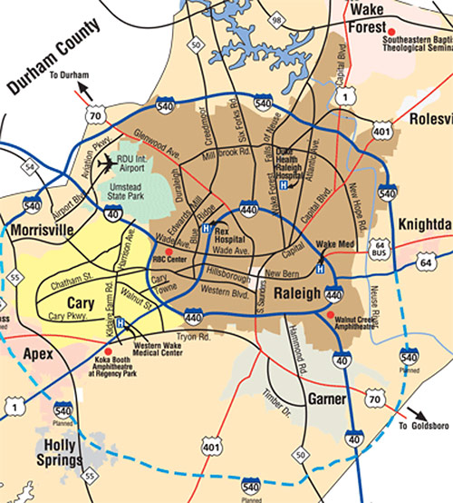
Take I-40 East. Take Exit 299 (Person Street), and turn left off exit. After approximately 1 mile you will be in central downtown. Turn right at any cross street to head towards Fayetteville Street (3 blocks from Person St). Festival activity will be on Fayetteville Street with our art market, Kidsplosure, and musical stages will be two blocks up on Fayetteville Street. Park anywhere in the area, or go a few blocks and take a left onto Edenton Street for additional parking lots.
From East Raleigh
Take I-40 West to Exit 299 (Person Street). Take the right turn off the exit toward the city of Raleigh. After approximately 1 mile you will be in central downtown. Turn right at any cross street to head towards Fayetteville Street (3 blocks from Person St). Festival activity will be on Fayetteville Street with our art market, Kidsplosure, and musical stages will be two blocks up on Fayetteville Street. Park anywhere in the area, or go a few blocks and take a left onto Edenton Street for additional parking lots.
From North Raleigh
Take Hwy. 70 (Glenwood Avenue) all the way until it dead-ends downtown at Morgan Street. Take a left onto Morgan Street.
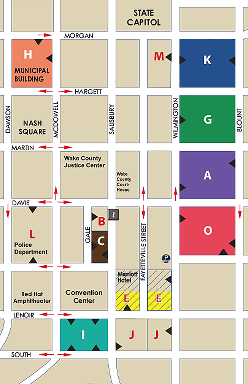
There are numerous parking decks and lots located in the downtown area. The closest to the festival are the Blount Street and Moore Square Station parking decks with entrances on Wilmington Street. The Wilmington Street parking deck, located between Hargett and Morgan Streets, has entrances on both Wilmington and Blount Streets at the northern end of the festival, opposite Marbles Kids Museum. The City Center parking deck (entrances on Wilmington or Blount Streets, between Cabarrus and Davie Streets) near the festival.
This year, the festival is also on Fayetteville Street. Please see the city parking map below for more parking along the festival route.
For more information about parking in downtown, visit the Downtown Raleigh Alliance’s website.
State government-owned surface lots along Edenton and Jones Streets, several blocks north of the festival footprint, are also available to the public for free on weekends.
Public Transportation
Raleigh public CAT bus routes which terminate at the Moore Square Transit Station will let passengers off adjacent to the festival.
The Raleigh R-Line ciruclator bus will bring passengers to within one block of the festival. The R-Line runs a continuous loop around downtown Raleigh and is free of charge. Visit the Downtown Raleigh Alliance for details about the R-Line.


